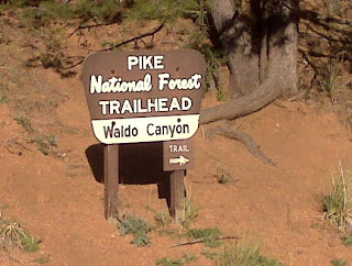
 Well, in Pike National Forest if you'd really like to know, and to my great disappointment none of the mountains or trees were dressed in red and white striped shirts or blue pants. Alas. But everything else about that hike offered no more disappointments. To say this trail was challenging, fun, and beautiful is to do it a grave injustice. All the words I can think of for this experience would be understatements, and all the pictures I'll show you will not do the views justice, but until you come out here and hike the trail yourself, this will have to do. :)
 The trail starts just off of highway 24, and begins with a few roughhewn steps up to the trail that leads to the Waldo Canyon loop.
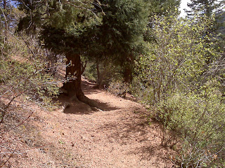
 From the top of the steps and up a bit on the trail to the canyon, the highway is already far below. I've only gained probably about 100 0r 150 feet in altitude in this picture, a fraction of the 2000 feet I gained by the time I reached the summit of this trail.
 The trail to the Waldo Canyon loop is a little over a mile and a half long itself, and offers some pretty spectacular views along the way. It was a perfect day for hiking: warm, the breeze was very slight, and there were barely any clouds in the sky. Still, though I started the hike in shorts and a t-shirt, I had packed a long sleeve shirt in my backpack . While it was a sunny 75 degrees at the start of the trail, the weather changes pretty quickly 2000 feet higher, and can get cold before you know it. Also in my backpack were my water bottle, an apple, and of course, my blackberry because while it becomes useless as a phone once you enter the canyons, its camera still works just fine.
 The trail winds around and up the canyon's edge, pretty darn CLOSE to the edge a lot of the time. One wrong step and you'd be off on a fast journey down the side of the mountain. Syl, Mom, I don't think you'd like it. :) The trail itself is made of red sandstone and pink Pike's Peak granite bits and most of the time isn't more than 2 feet wide.
 About halfway through the mile and a half trail to the loop, I came across this amazing rock formation on the inside of the canyon wall. I could hear a waterfall coming from that direction, and after staring and squinting at it, I found it hidden in a crack right down the middle. I knew the picture wouldn't do it justice, but if you click on it and magnify it, it looks almost half as cool as it did in real life. :)
Right before you reach the Waldo canyon loop, the trail suddenly opens up and leads you across this grassy knoll. I'm not gonna lie, being in the open like that made me a little nervous. As beautiful as the trail was and as much as I was enjoying the sights, in the back of my mind always lurked the thought that I was alone, and there were predators up here that were bigger than me. I expected to see the big black shape of a bear moving through the trees, or hear the scream of a cougar any second. Silly, maybe, seeing as it's a very populated and well traveled trail (I probably passed 7 or 8 other hikers during my 3 and a half hour Odyssey through the canyon), but hey, better paranoid than taken by surprise, right?
I finally found the trail head and took the pass to the right. Turns out, according to the hikers I passed (which were ALL heading in the opposite direction), that was the hard way to start. And hard it WAS. Very uphill with a lot of scrambling over loose granite gravel. I was breathing pretty hard by the time the trail leveled out, but the view immediately took my mind off of the thinner air. On the hike up into the canyon and towards the loop, I wondered when I'd get high enough to see Pike's Peak over the lower mountain tops. As soon as I stood up from being bent over gasping for breath, I was greeted by this sight: Pike's Peak reigning over the skyline.
 Turning the other way, I could see over the rest of the canyon and out east to the flatter, desert like Colorado landscape.
All along the trail bunches (not sure of the scientific term for groups of cactus plants...bunches will have to do) of cacti sprouted up on both sides of me. Another reason to watch your step. :)

Further up along the trail, the skyline becomes even more dramatic, opening up and allowing me to see for miles. That's probably Kansas over there where the sky meets the land. Who knows?
 At about 2 hours into the hike, I began to really feel the work my legs were doing, though my feet and ankles were quite comfortable in my new Salomon hiking shoes! :) I stopped at one point to rest, and was astounded when I looked up. I stood and watched as a group of storm clouds swept across the blue sky and touched the tip of Pike's Peak. It's unreal to think about how close the sky is here.
Another half hour into the hike and my stomach rumbled to remind me how much work I was doing, and how long ago breakfast had been. I had been so excited about my new shoes, the beautiful weather, and this hike, that I hadn't stopped to eat lunch after leaving work at 2pm. I'd brought the leftovers from a pasta dinner I'd made myself the night before and eaten them around 10am when I had my 30 minute break, and had only water and coffee after. It was close to 5:30pm now, and that apple in my backpack was sounding really good. I planned to stop for a rest and a snack when I found a suitable place. Suitable doesn't even begin to describe it.
 This outcropping of rock along the trail probably hung about 200 or 300 feet above the tops of those evergreen below. The view was spectacular, and of course I had to climb out on it. Sorry, mom. :)
 As I suspected, the picture doesn't at all convey the awesome height and beauty of this place, but I got my foot in the shot...aren't my hiking shoes cool? ;)

Small, but still quite a lovely little mountain stream. I came across many different little waterfalls as it wound it's way down inside of the canyon. The trail was now in the woods, and the temperature noticeably cooler in the shade. The air was thick with the smell of fresh pine sap, and the trail as leading me downhill (at last!)...I couldn't be happier.

I continued to follow the stream, all the while the shortly forgotten fear of predators slowly seeping back into my mind. This was a water source, after all. Something frequented by predators and prey alike. I made sure to keep my eyes up and roaming as much as I could without risking a broken ankle by tripping over the large rocks on the trail. As I traveled deeper into the forest and my surroundings grew darker and colder, I began to wish I had brought a hiking partner with me...or at least a knife. Then, I stumbled upon another waterfall in the stream, and left the trail to get a closer look. I climbed out onto a rock that was covered in wet red clay and sand in order to get a picture. It came out rather sideways, but you get the point. :)
 Turning the other way, I could see over the rest of the canyon and out east to the flatter, desert like Colorado landscape.
All along the trail bunches (not sure of the scientific term for groups of cactus plants...bunches will have to do) of cacti sprouted up on both sides of me. Another reason to watch your step. :)

Further up along the trail, the skyline becomes even more dramatic, opening up and allowing me to see for miles. That's probably Kansas over there where the sky meets the land. Who knows?
 At about 2 hours into the hike, I began to really feel the work my legs were doing, though my feet and ankles were quite comfortable in my new Salomon hiking shoes! :) I stopped at one point to rest, and was astounded when I looked up. I stood and watched as a group of storm clouds swept across the blue sky and touched the tip of Pike's Peak. It's unreal to think about how close the sky is here.
Another half hour into the hike and my stomach rumbled to remind me how much work I was doing, and how long ago breakfast had been. I had been so excited about my new shoes, the beautiful weather, and this hike, that I hadn't stopped to eat lunch after leaving work at 2pm. I'd brought the leftovers from a pasta dinner I'd made myself the night before and eaten them around 10am when I had my 30 minute break, and had only water and coffee after. It was close to 5:30pm now, and that apple in my backpack was sounding really good. I planned to stop for a rest and a snack when I found a suitable place. Suitable doesn't even begin to describe it.
 This outcropping of rock along the trail probably hung about 200 or 300 feet above the tops of those evergreen below. The view was spectacular, and of course I had to climb out on it. Sorry, mom. :)
 As I suspected, the picture doesn't at all convey the awesome height and beauty of this place, but I got my foot in the shot...aren't my hiking shoes cool? ;)
After being on the trail for about 3 hours, I began to get worried. The website had described this hike as being about 4 hours long, and having a stream that had to be crossed 'several times', and I was still ascending. I certainly didn't expect to find a stream up where I was. Had I somehow gotten off the trail? I had been lead astray earlier in the hike by a side trail that had been made by hikers before me, but had figured it out pretty fast and had corrected my path. So where was this stream, and was I ever going to reach the summit?
Ye of little faith, I began my descent not long after I had that slight panic attack. It was just like something my sister Katie had said to me once while we were driving in an unfamiliar part of California: "Just when you think you've gone too far, you haven't gone far enough", and that statement usually holds true. The stream was small and the crossings were easy, just like the website had foretold.

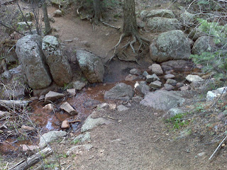
Small, but still quite a lovely little mountain stream. I came across many different little waterfalls as it wound it's way down inside of the canyon. The trail was now in the woods, and the temperature noticeably cooler in the shade. The air was thick with the smell of fresh pine sap, and the trail as leading me downhill (at last!)...I couldn't be happier.

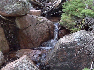
I continued to follow the stream, all the while the shortly forgotten fear of predators slowly seeping back into my mind. This was a water source, after all. Something frequented by predators and prey alike. I made sure to keep my eyes up and roaming as much as I could without risking a broken ankle by tripping over the large rocks on the trail. As I traveled deeper into the forest and my surroundings grew darker and colder, I began to wish I had brought a hiking partner with me...or at least a knife. Then, I stumbled upon another waterfall in the stream, and left the trail to get a closer look. I climbed out onto a rock that was covered in wet red clay and sand in order to get a picture. It came out rather sideways, but you get the point. :)
After finding the trail again and coming to another crossing of the stream, I bent down to wash the grit off of my hands in the gently trickling water. Sidenote: mountain streams are COLD.
As I was finishing, I suddenly heard a growl right by my head. I gasped out loud and whipped around to see a golden hued animal flash along the trail. My heart stopped dead in my chest for 2.9 seconds and I seriously believed I would have to fight a mountain lion in those eternal moments. Then, a golden lab bounded out from behind a tree. It was only barely out of its puppy stage, its ears floppy and still nervous of people who are not its master: hence the growl. Followed closely in its paw prints were two other labs, both black, and both much older and wiser. They seemed to take no notice of me as they trotted past, their owner on his mountain bike right behind them. I smiled and gave a nervous laugh and a high pitched hello, and felt my heart slide back down my throat and into my chest where it slowly calmed down.
As it had been a physically and now an emotionally draining journey, the sight of the Waldo loop trail sign may be one of the sweetest sights I've ever beheld, whether the look on my face says it was or not. :)
Though I had reached the sign, I still had another mile and a half to go to get back to my car, but I had done it! The Waldo canyon loop hike was another I could check off my list. All said and done, I'm proud of myself, and the views were so spectacular I'd do it again. And no matter what the other hikers said, I'd take the same route; it was nice to end the long hard hike with a trail through the woods and next to a winding mountain stream...and next time I'll look for dogs before jumping to terrifying conclusions. :)
Stay tuned!


Aw... fun times KC!
ReplyDeleteI hiked Tiger Mountain in Seattle and it was 2000ft increase in elevation in 3.1 miles so I definitely feel some of your pain! I had the exhausted face picture as well. Though I'm sure you did way better than me seeing that you've become quite a professional with all these trails!
Casey, my love. I am so happy you're having fun, but please, please try not to hike by your onesies. What if something were to happen? You know me, I'm a worry wart! Be safe and have fun!!!
ReplyDelete